Trail number
Not applicable
Trail length
21 kilometres
Elevation variance
120 metres
Trail type
Single trail, motor bike track, fire trail, gravel road and bitumen road
Trail surface
Smooth dirt, mud, rocks and rock outcrops
Weather affected
Prone to be muddy after medium rain
Trail condition sources
Nil
Trail features
Mining and logging history in area, some steep climbs
Trail obstacles
Mud (lots of it when wet especially the southern section near Yankee mine area)

Trail rating
Difficult
Rating basis
Estimated
Night riding
No - some steep sections on this loop which are best negotiated during daylight hours.
Family Friendly
No

The 21 km loop (refer pink route on map above) is made up of a lot of single track mixed with narrow logging truck trails which are gradually revegetating. Note that the single track parallel to Countess Road gets extremely muddy due to trail bike riders entering the wet areas and cutting them up a fair bit so this part of the circuit should be bypassed when wet by using Countess Road. This part of the trail can be a really hard slog in the wet! There are numerous other side trails as well as you go through the area.
My preference with rides is to always start at a low point so you get a good run home! From this perspective, I recommend starting at the Yankee Mine parking area. To get there, follow the Greendale - Trentham Road and head east along Yankee Road and past Old Blackwood Road. You will come to a single lane bridge. Proceed up the hill until you see a large mullock heap from the mine and park there. It is located just before Yankee Track on the right.
I think I would tend to do this course in a clockwise direction as most of the hills can then be ridden - there are a couple of very steep climbs depending on your fitness. The climb out of the Yankee Mine area on Countess Track is very very steep and very very rutted (some are 600 mm deep!). When I took the photos below, it was wet and unrideable so there was a bit of hike a bike in that area but you get a lot of elevation quickly so it's not all bad. It would be easier riding down this however obviously.
There's also a short 50 - 100 metre hike when crossing the creek at Snake Track as the creek walls are fairly steep. Otherwise most of it is rideable depending on your fitness.
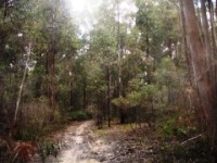
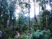
The trail notes below run in an anti clockwise direction as that is the direction I took when taking the photos. The following photo gallery has been taken in order from the Yankee Mine area.
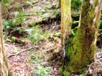
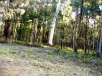
Below is a photo of the turnoff to Countess Track on the left as you head east into the mine area plus a picture of the local creek. From the mullock heap car park head west a short distance (about 100 metres) and turn right onto it once you've got organised.
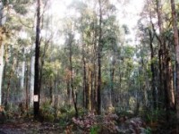
Be very careful walking through the bush in this area - the third picture below is a very deep shaft which is unmarked. Quite a few are marked with star pickets and tape as in the fourth photo. The fifth and sixth photos show an old water race now filled with ferns which used to carry water to the mines along the contours of the hills.
Having said that, it is worth having a walk around as there are some old crusher foundations and boilers from the old gold mining machinery in the area.
 |
 |
 |
|---|---|---|
Countess Track turnoff when coming up the hill from the creek bridge, small creek and exposed mine shaft in bush |
||
 |
 |
 |
|---|---|---|
Shaft marked with tape in the distance and water race with fern trees growing in it. |
||
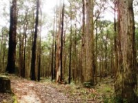
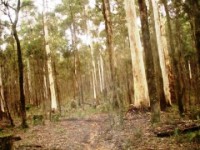
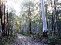
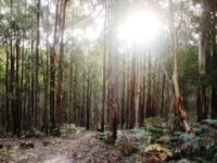
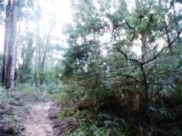
The photos below show the heavily rutted surface of the Countess Track. The photos don't do justice to how deep some of these ruts are and it would make an interesting and technical ride in the downhill direction. You might get up it in dry conditions - it would definitely test you stamina and skill. These tracks tend to get graded once a year typically once they have dried out so you may get it in good condition at certain times of the year.
 |
 |
 |
|---|---|---|
Ascending Countess Track from Yankee Mine area |
||
 |
 |
 |
|---|
 |
 |
 |
|---|---|---|
Still ascending and deep mineshaft at road side |
||
 |
 |
 |
|---|
 |
 |
 |
|---|
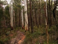
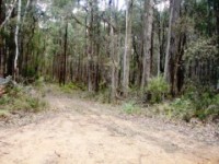
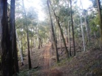
As you go up Countess Track there are a number of tracks off to the left and right. An example of one is shown below. These vary from motor bike single track to logging tracks in size. Explore if you wish...
 |
 |
 |
|---|
 |
 |
 |
|---|
 |
 |
|---|
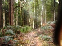
Just before getting to Countess Road on Countess Track, there is a single track off to the left. It's shown in the first photo below - bit hard to see with the plant in foreground but it runs though the middle of the photo. If you don't have GPS, its on the west side approximately 200 metres before Countess Road. Once on it, it's easy to follow. Other photos below of the actual singletrack. I've left out most of the pictures of the motor bike bog holes except a couple, the below is what it would look like when dry.
 |
 |
 |
|---|---|---|
Trail entry at left - this area can get very muddy in winter due to motorbikes cutting it up. If this is the case you can just head up Countess Road a bit and pick up the trail further up. There are a couple of entry points along Countess Road. |
||
 |
 |
 |
|---|
 |
 |
 |
|---|
 |
 |
 |
|---|
 |
 |
 |
|---|---|---|
A steeper piece of track along the way. |
||
 |
 |
 |
|---|
 |
 |
 |
|---|---|---|
Typical motor bike damage during the wet months - some sections near the start can get quite bad. You can usually skirt around the edges. |
||
 |
 |
 |
|---|---|---|
Heading north from start of trail. |
||
There are two entry points to the single trail further up Countess Road - the photo below shows the entry from Countess Road at GPS location S37 24.595 E144 19.708. In wet conditions, you could enter here as the trails are better draining from this point on. The second entry from Countess Road and is located at GPS location S37 24.328 E144 19.551. Just after this are some diggings with posts around them with a large pile alongside. I think this may be an old sawmill site with the hole being the sawpit though not totally sure.
 |
 |
|---|---|
Photos showing two entry points from Countess Road. |
|
K Track is marked with a sign as shown in the first photo - follow it west.
 |
 |
 |
|---|---|---|
Heading west from start of trail. |
||
 |
 |
 |
|---|---|---|
Short creek ford on trail |
||
 |
 |
 |
|---|
 |
 |
 |
|---|---|---|
Left photo shows a large fern glade in a large excavation - this may have been a sluicing site during the mining period. |
||
At the three way intersection, head down the track heading to the south east. This is Snake Track and starts out as a fire trail but reduces as you go on as it has been starting to be grown over.
 |
 |
 |
|---|
 |
 |
 |
|---|
 |
 |
 |
|---|
 |
 |
 |
|---|
Follow the trail for about 2 km, looking for a single track off to the right (GPS location S37 25.786 E144 19.300) as shown in the first photo below. If the trail starts heading down steeply you've gone too far. Follow this track down steeply to Snake Gully Creek - it looks bad as it looks like a dead end in a deep gully but the track veers off to the right along the creek. You'll have to hike a 100 metres or so down into the creek bed and back up the other side as it's very steep. Keep following the trail and you will pop out on Old Blackwood Road. Head South to Albion Track on the right.
 |
 |
 |
|---|
 |
 |
|---|
From here you have a number of options. The first is to follow Old Blackwood and Yankee Roads back the Yankee Mine area.
The other option is to take in the northern section of the Sweet Nuggs ride by turning right onto Albion Track. After 600 metres on Albion Track (GPS location S37 26.182 E144 18.852), there is a single track heading off to the left which heads to the northern end of Sweet Nuggs if you don't wish to do the western half of the Sweet Nuggs single track (refer blue short cut on map).
Otherwise follow Albion Track to Yankee Road. Head south down Albion Track for a further 500 metres and turn left onto the singletrack heading down into the creek valley. This forms the northern part of the Sweet Nuggs track and this trail information is repeated here. The entrance to the single track is shown in the photo below.
 |
||
|---|---|---|
Entry to the Sweet Nuggs trail from Albion Track |
||
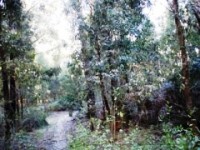
Photos below show single track leading along Nuggety Gully up to Yankee Road along western side of Nuggetty Gully.
 |
 |
 |
|---|
 |
 |
 |
|---|
 |
 |
 |
|---|
 |
 |
 |
|---|
 |
 |
 |
|---|
At Yankee Road, turn right onto Yankee Road and then back onto the single track about 50 to 100 metres or so along Yankee Road on the right.
 |
 |
 |
|---|
 |
 |
 |
|---|
 |
 |
 |
|---|
 |
 |
 |
|---|
Once you get back to the Old Blackwood Road, you leave the Sweet Nuggs circuit. Head straight ahead at the intersection with Old Blackwood Road and head over to the Yankee Mine area via the thin fire trail / single trail. This has a mix of uphills and downhills.
 |
 |
|
|---|

 |
 |
 |
|---|---|---|
When your tyres match the ground you know its clayey and slippery. |
||
The trail continues across to the Yankee Mine area and comes out on Yankee Road just west of the mine area. Follow Yankee Road down to the mine area (near the intersections of Yankee Track and Countess Track) - you will see the mullock heap on the left. Refer to Yankee Track for a few features of this area.
 |
 |
 |
|---|
 |
 |
|---|
Videos only available for the Sweet Nuggs portion of this loop.
 |
Parking is available at Yankee Mine |
|---|---|
 |
No toilet facilities are available. |
 |
No drinking water is available. |
 |
No food or drinks are available in the immediate area. |
 |
No local information facilities are available. |